
Edmonton boasts a vast network of beautiful parks, brimming with diverse flora and fauna. But the city’s green spaces looked a bit different in its early days. Let’s delve into how the Alberta capital’s parks came to be and what makes them unique.
Early History
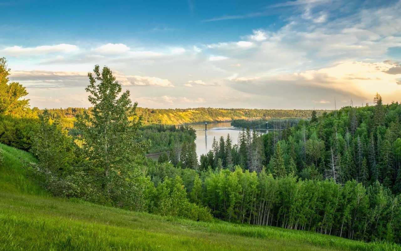
Indigenous peoples from various nations—Cree, Dene, Iroquois, Inuit, and others—were the original inhabitants and stewards of Edmonton’s river valley. Evidence from various sources suggests these nations have lived on Turtle Island for tens of thousands of years. This has been confirmed by archaeological finds at a site in a river bend near the E.L. Smith Water Treatment Plant, with artifacts dating back 9,000 years. The Indigenous peoples who lived and traded in this area developed cultures that ensured sound land management for millennia.
The first Europeans arrived in the 18th century. By 1795, both the North West Company and Hudson’s Bay Company had built forts here. In 1802, both forts relocated to what is now Rossdale, and by 1915, they ceased to exist entirely. In 1876, the region’s Indigenous peoples signed Treaty No. 6, though the situation was more complex for the Papaschase Cree as European colonization had already begun. Outside the fort, farms were established under the river lot system, introduced in 1882. This marked the start of colonialism in the area, a legacy that continues today.
As Fort Edmonton grew and the city developed, much of the river valley was used for industrial purposes, including coal mines, sawmills, brickyards, and even landfills. In 1907, the city hired Canada’s first landscape architect, Frederick Todd, to create a park system. Todd immediately recognized the immense potential of the river valley’s and ravines’ natural beauty. He also emphasized the importance of reserving land along the top of the bank for public roads, allowing people to admire the valley’s splendour below.
Between 1907 and 1931, the city established over 100 park areas. During this period, it also acquired most of the land on both sides of the river, stretching from the Highlands Golf Course to Laurier Park. Edmonton also purchased land in the Mill Creek, Groat, Mackinnon, Kinnaird, and Whitemud Creek ravines during this early expansion.
The Dawn of Deindustrialization and Park Development
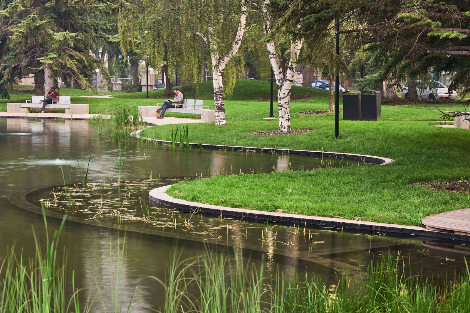
Over the next two decades, the city embarked on a deindustrialization effort within the North Saskatchewan River Valley. The desire to create beauty was complemented by a yearning for spaces where people could improve their health and well-being. The initial goal of creating parks in the early 20th century was to provide city dwellers with a respite from urban hustle, offering opportunities to connect with nature, fish, skate, and toboggan. By the late 1940s, parks had become popular recreational spots. A less fortunate situation arose when the city’s transportation department began developing an urban freeway system, almost costing Edmonton its river valley parks. The plan was to use both the river valley and its ravines as expressways leading into the city centre. The Mill Creek Expressway project was only cancelled in the 1960s after strong public protests. However, work in MacKinnon Ravine had already begun, and today, this park is a wide corridor due to tree removal and road construction. Following the halt of the “Metropolitan Freeway System” project, the province continued creating parks. Edmonton saw the development of the Capital City Recreation Park, a $35 million investment. At the time, the city and province aimed to connect green spaces from Hermitage to High Level. This involved acquiring small parcels of land to complete the system of riverside trails. Unobtrusive pedestrian and cycling paths, along with four pedestrian bridges, made it easier to move between parks. Former Alberta Premier Peter Lougheed noted that the Capital City Recreation Park embodied the concept of a high quality of life for Edmontonians and their children. Under an agreement between the city and province, all park changes required approval from the provincial Ministry of Environment. The Capital City Recreation Park was a resounding success, and the trail system expanded to include existing parks in western Edmonton, such as Victoria, Emily Murphy, Mayfair, Whitemud, and Laurier. Furthermore, recreational opportunities broadened from picnics and tobogganing to hiking, cycling, and running.
Conservation Efforts and Environmental Planning
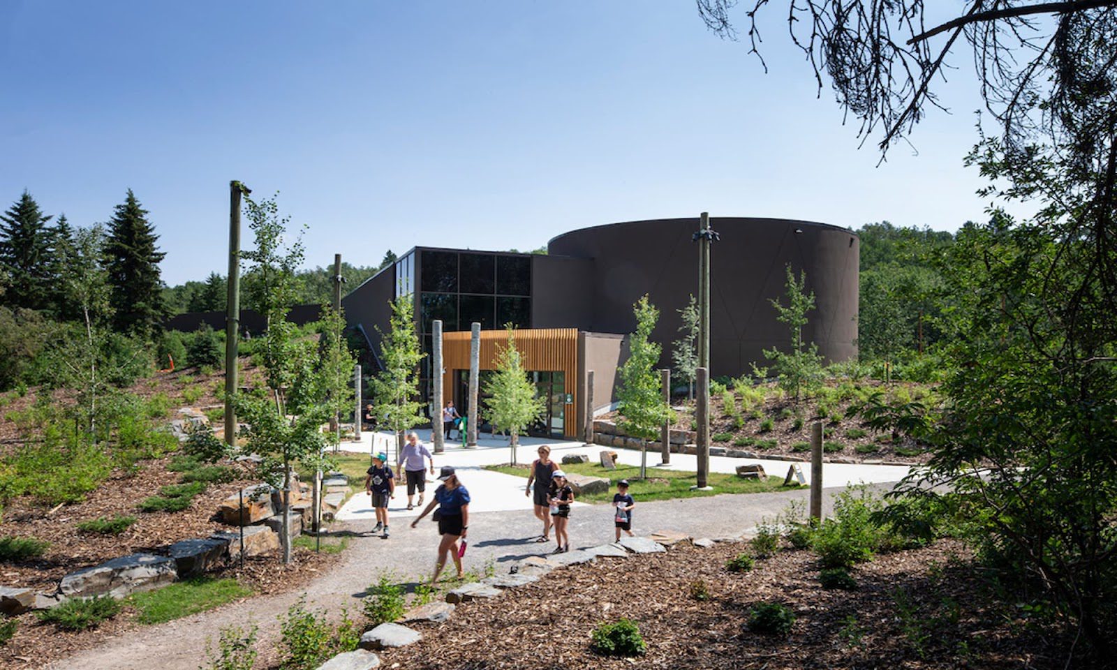
The creation of such a vast park system spurred significant conservation efforts by the city to protect the river valley. In 1976, the John Janzen Nature Centre opened, aiming to raise environmental awareness among citizens. The 1985 River Valley Bylaw provided legal protection for the parks, bringing Edmonton’s river valley parks to an impressive 18,000 acres. However, the bylaw also highlighted the near-complete loss of the Capital City Recreation Park due to the freeway system’s construction. As Edmonton grew and changed, and land values increased, the river valley faced threats from commercial and industrial development. In the 1990s, the city recognized the river valley’s crucial ecological value, as its boundaries encompassed areas with natural vegetation and wetlands that contributed to the city’s biodiversity. During this period, the “Ribbon of Green” document was published, emphasizing conservation. In 1995, the “Natural Areas Policy” was developed, and a few years later, the “Master Naturalist” program and the Natural Areas Advisory Committee were established to raise public awareness about the river valley’s ecology and conservation methods. In 2007, the “Natural Systems Policy” was introduced. In 2008, the city released a report on Edmonton’s biodiversity, noting that the city’s natural areas were under pressure from commercial and industrial development. Many had already been degraded, fragmented, or entirely lost. In 2011, the city created “The Way We Green,” an environmental master plan that included two crucial points: Edmonton protects, preserves, and enhances its system of protected natural areas as part of a functioning and interconnected ecological network. The city protects its urban forests, the North Saskatchewan River Valley, and ravine system as its greatest natural assets.
A New Chapter: Shifting Values
In recent years, the city’s understanding of its role as a steward has shifted somewhat. A clear example is the cancellation of the “Master Naturalist” program and the disbandment of the Natural Areas Advisory Committee. Then, in 2016, the city began constructing the Valley Line LRT, which runs through five river valley parks. This led to the felling of over 1,600 trees in the southeast section alone. The environmental impact assessment indicated that the line would impede wildlife movement and negatively affect the local ecosystem. In 2016, the Environmental Law Students’ Association at the University of Alberta conducted a gap analysis of river valley protection. They concluded that the North Saskatchewan River Valley and the city’s ravine system were not receiving effective protection, and the city was not assessing the cumulative impact of the projects it approves and plans. In response, the Edmonton River Valley Conservation Coalition was formed. Today, Edmonton boasts the largest park system of any North American city, contributing to ecological preservation and providing Edmontonians with abundant opportunities to connect with nature.